
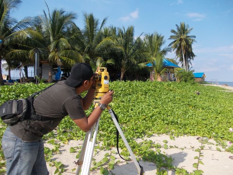
If you are a contractor or engineering office looking for a total station in Saudi Arabia, the short answer is: choose by the work you do, not by brand reputation. Angular accuracy, reflectorless range, robotic versus manual operation, the data collector and its field software, and local service and calibration support decide whether an instrument serves your projects for years or becomes a burden. This guide walks through each factor so you can compare offers neutrally.
Looking for the best surveying office in Saudi Arabia? Read our guide to choosing the best surveying office in Saudi Arabia: licence, classification, KSA-GRF17 and deliverables.
What a total station does and when you need one
A total station measures horizontal and vertical angles and electronic distances, then computes coordinates and heights on site. Surveyors use it for setting out grids and columns, detail surveys of buildings and roads, as-built drawings, settlement and deformation monitoring, and staking plot corners before fencing. GNSS RTK complements it in open areas, but inside buildings, between towers, under bridges and in tunnels the total station remains the main precision tool. For the wider picture, see the survey team's role on major Saudi projects.
Angular accuracy: how many seconds do you need?
Accuracy is quoted in arc-seconds, such as 1", 2" or 5". Match it to your project tolerances:
- Residential setting out, fencing and plot detail surveys: 2" or 5" is usually enough with sound procedures.
- Industrial plants, bridges and steel erection: 1" or 2", with face-left/face-right readings and repeated sets.
- Deformation monitoring: high accuracy, stable mounts, protected reference points and monitoring software.
Nominal accuracy only appears with a calibrated instrument, stable tripod and correct levelling. Midday heat shimmer in Riyadh or Qassim can introduce errors larger than the difference between a 1" and 2" instrument, so schedule critical observations early or late in the day.
Reflectorless range is not a single number
Reflectorless mode lets you measure facades, ceilings and excavation walls you cannot reach. Catalogue range is measured on ideal targets; real range depends on surface colour, incidence angle and light. Pale limestone and new concrete reflect well; dark basalt in the Madinah harrat or asphalt can shorten range; edges can split the laser spot and give misleading readings. Ask for both prism and reflectorless range with test conditions, and try the instrument on surfaces like yours.
Robotic or manual?
A manual instrument usually needs two people. A robotic one tracks the prism and is driven from the data collector at the pole, so one surveyor can handle much of the work.
- Robotic suits: dense setting out on large projects, topographic surveys with many points, automated monitoring.
- Manual is enough for: intermittent work, two-person crews, and sites where output speed is not critical.
Before going robotic, check that your crew is trained and that technical support is close by.
Data collector and field software
- Support for Saudi coordinate systems, including KSA-GRF17 and UTM zones 36 to 39 (see our KSA-GRF17 guide).
- Import and export formats such as CSV, DXF and LandXML, and loading design files for direct stakeout.
- A screen readable in strong sun and a battery that lasts a full shift.
You can sanity-check conversions with the coordinate converter.
Brands, local support and the buying decision
The Saudi market offers instruments from Leica, Topcon, Sokkia, Trimble, Hi-Target and South, each with models at different accuracy and feature levels. Compare model to model, and add: a local dealer or service and calibration centre, spare parts availability, compatibility with your existing GNSS equipment, warranty scope and crew training at handover.
Buy or rent? For short projects or a robotic instrument needed for one phase, renting may fit better; continuous work usually justifies buying. Compare both in our buy-or-rent guide and browse categories on the products page.
Common mistakes
- Buying the highest accuracy for work that does not need it while neglecting training.
- Trusting catalogue reflectorless range without a field test.
- Ignoring field software support for local coordinate systems.
- Accepting an instrument without a recent calibration certificate.
Official and project requirements change, so check the GEOSA portal and your supervising consultant's specifications before fixing instrument specs.
FAQ
Can GNSS RTK replace a total station?
Not always. RTK excels in open areas, but a total station is still needed indoors, between tall structures and for high-accuracy short-range work.
What accuracy suits a residential contractor?
Usually 2" or 5" with sound field procedures and regular calibration. Field discipline and checked control points matter more.
Do I need a robotic instrument from day one?
Not necessarily. If your setting out is dense and continuous, robotic can save crew time; otherwise a manual instrument with a two-person crew is practical.
How EL EMAN can help
We are preparing to serve projects in Riyadh, Jeddah, the Eastern Province and other cities with surveying, contracting and equipment sales and rental, and are taking requests now via WhatsApp or the contact form.


