
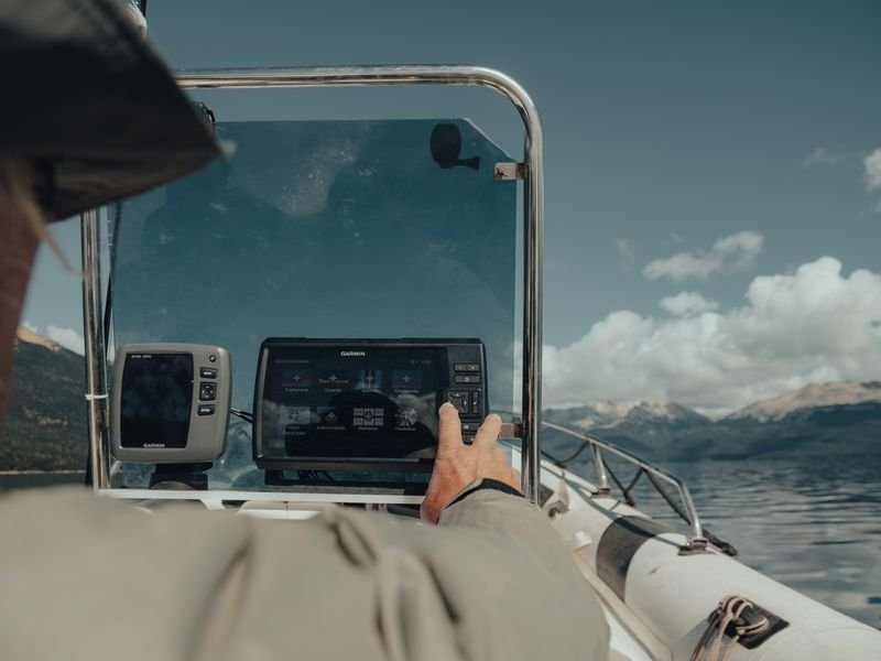
A hydrographic survey in Saudi Arabia measures water depth, seabed shape and submerged features near the coast, tied to coordinates and a clearly defined vertical datum, for coastal projects on the Red Sea and the Arabian Gulf: marinas, jetties, dredging, reclamation, shore protection and outfalls. It relies on echo sounders with GNSS positioning and careful tide handling. Hydrographic survey is an activity for which GEOSA issues permit terms, so obtain the required permits before work and check the official requirements.
Looking for the best surveying office in Saudi Arabia? Read our guide to choosing the best surveying office in Saudi Arabia: licence, classification, KSA-GRF17 and deliverables.
When you need one
- Marina and jetty design: channel and basin depths.
- Dredging: pre-survey for quantities and post-survey for verification and payment.
- Reclamation and beach works: seabed form before fill and volumes.
- Shore protection and shoreline change monitoring.
- Pipeline and cable routes, intakes and outfalls.
- Repeat surveys where siltation or scour occurs.
Equipment
- Single-beam echo sounder: depth below the boat along set lines; fits small jobs and shallow water.
- Multibeam echo sounder: a wide swath per pass and a dense model for ports and dredging.
- GNSS RTK for vessel position and vertical support.
- Motion and heading sensors, essential with multibeam.
- Sound velocity measurement, since speed of sound varies with temperature and salinity in warm, saline Gulf and Red Sea waters.
- Side-scan sonar for obstructions where needed.
- Tide gauge nearby during the work.
Tides and vertical datum
The sounder measures from transducer to seabed, but the water surface rises and falls with the tide. Every reading must be reduced to a fixed vertical datum, and this is where most errors occur.
- Agree the output datum with designer and owner; marine depths may refer to a chart datum while land drawings use land levels.
- Document the relationship between marine and land datums on site so soundings merge with shore topography.
- Record water level with a tide gauge throughout, or use GNSS vertical methods with a suitable model.
- GNSS heights on KSA-GRF17 are ellipsoidal and need a geoid model or a documented separation.
- State horizontal datum, UTM zone, vertical datum and tide method on every drawing.
For the horizontal side see the KSA-GRF17 and UTM guide: Jeddah and Yanbu are in 37N, Dammam, Khobar and Jubail in 39N, NEOM west of 36°E in 36N.
Red Sea vs Arabian Gulf
Red Sea (Jeddah, Yanbu, NEOM)
Coral reefs line much of the coast and depth can change quickly, so plan vessel paths and line density carefully near reefs and respect environmental constraints. See Jeddah and Tabuk and NEOM.
Arabian Gulf (Dammam, Khobar, Jubail)
Wide shallow areas, flat shores with sabkha and tidal flats; boats may not reach very shallow water, so the intertidal zone is completed by ground survey at low water or other means. See Dammam and Khobar.
Joining land and sea
- Use the same stable shore control for land and marine work.
- Leave enough overlap between the two surveys to compare.
- On coastal sabkha, set control on stable ground; see surveying rocky and sabkha ground.
- Merge depths and levels on one vertical datum before building the surface.
Permits and licensing
GEOSA issues terms for hydrographic (marine) survey permits, and companies practising survey need a GEOSA licence, applied for online via its portal; its geospatial licences and permits system launched in July 2025. Obtain the permits before launching, and check other requirements for working in water or coastal sites with the competent authorities.
Common mistakes
- No stated vertical datum, mixing depths with land levels.
- Skipping tide records or relying on approximate tables.
- Not measuring sound velocity.
- No cross-lines to reveal calibration errors.
- A gap between marine and land survey at the shoreline.
- Starting before permits are complete.
Official requirements change, so check the GEOSA portal before planning any marine survey.
FAQ
Single-beam or multibeam?
Single-beam measures one point under the boat along spaced lines; multibeam covers a full swath and suits ports and dredging.
Why do two surveys of the same site disagree?
Usually different vertical datum, tide reduction or sound velocity, or real siltation or scour. Document datum and corrections every time.
Does a marine survey need a permit?
Yes. Hydrographic survey is an activity GEOSA issues permit terms for, so check its portal and get permits before starting.
How EL EMAN can help
We are preparing to serve projects in Riyadh, Jeddah, the Eastern Province and other cities with surveying, contracting and equipment sales and rental, and are taking requests now via WhatsApp or the contact form.


