
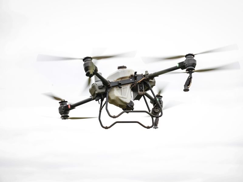
Drone surveying in Saudi Arabia means photographing a site from an unmanned aircraft with overlapping images, then processing them by photogrammetry into an orthomosaic, a digital surface model and a point cloud tied to KSA-GRF17 through ground control points. It suits large open sites, progress monitoring and stockpile volumes, but it does not replace ground survey everywhere. Above all, aerial photography and aerial survey are activities for which GEOSA issues permit terms: obtain the required permits before flying and check the official requirements.
Looking for the best surveying office in Saudi Arabia? Read our guide to choosing the best surveying office in Saudi Arabia: licence, classification, KSA-GRF17 and deliverables.
What a drone survey produces
- Orthomosaic: a uniform-scale image you can measure and digitise on.
- DSM: the top of everything the camera sees, including trees, buildings and plant.
- DTM: derived by filtering above-ground objects; quality drops under dense cover.
- Point cloud and contours, plus 3D models where needed.
When a drone fits
- Large open areas: subdivisions, farms, industrial sites.
- Repeatable progress capture on major projects.
- Stockpile, cut and fill volumes on open sites.
- Before-and-after site records.
- Hard-to-walk terrain, still with ground control.
Limits
- Vegetation: the camera cannot see ground under palms and dense trees.
- Built-up areas: corners under walls and canopies are unreliable, so it should not be the sole basis of a boundary survey for a survey report.
- Uniform surfaces: fine sand, sabkha and shiny surfaces reduce image matching.
- Weather: wind, dust and heat affect flights and images; long shadows hide detail.
- Precise levels: where tight vertical accuracy matters, ground survey remains the reference.
- Permits and restrictions: no flying without required permits; some areas are restricted.
Ground control and check points
GCPs are clear ground targets surveyed accurately by GNSS or total station to tie the model to correct coordinates. Check points are surveyed the same way but kept out of processing to measure real accuracy.
- Spread points around the edges and interior.
- Add more on long corridors and where relief changes sharply.
- Use high-contrast targets sized for flight height.
- Survey them on KSA-GRF17 in the right UTM zone, stating height type and geoid. See the KSA-GRF17 guide.
- RTK/PPK drones reduce GCP needs but do not remove check points.
What drives accuracy
There is no fixed accuracy; it results from several factors, and independent check points tell you the real figure on each job:
- Ground sampling distance (flight height and camera).
- Forward and side overlap.
- GCP distribution and accuracy.
- Camera quality and calibration.
- Surface texture.
Ask for a table of check-point residuals in the report, not a generic accuracy claim.
Permits before flying
GEOSA issues terms for aerial photography and aerial survey permits, and practising survey activities requires a GEOSA licence; its geospatial licences and permits system launched in July 2025, with applications online via its portal.
- Check the current official requirements on the GEOSA portal.
- Obtain the required permits before flying.
- Check any other aviation- or site-related requirements with the competent authorities.
- Keep a copy of the permit in the project file.
Drones by site type in the Kingdom
- Flat land such as Qassim: fast coverage, but small vertical differences need enough check points before drainage use.
- Riyadh scarps and wadis: higher overlap and possibly oblique images for rock faces.
- Madinah harrat: textured basalt matches well, but heat on dark surfaces limits flying hours.
- Makkah and Asir: large relief changes pixel size between peaks and valleys; terrain-following flight helps.
- Sabkha and coast: uniform, shiny surfaces need more control and ground infill.
Explore regions on our Saudi Arabia page.
Project steps
- Agree purpose, outputs and accuracy.
- Secure permits; study site and obstacles.
- Plan height, overlap and flight lines.
- Set and survey GCPs and check points.
- Fly at a time that limits shadows and heat.
- Process, then verify and fill weak areas with ground survey.
Weighing equipment ownership? See buy or rent surveying equipment and our products.
Common mistakes
- Flying before permits are issued.
- Relying on the drone's own GPS with no control or checks.
- Delivering a DSM as bare ground on a site with trees and plant.
- Clustering GCPs on one side.
- Using a drone for boundary survey in dense neighbourhoods.
Official requirements change, so always check the GEOSA portal before planning a flight.
FAQ
Do I need a permit to fly my project site?
Aerial photography and aerial survey are activities GEOSA issues permit terms for, so check its portal and obtain the required permits before flying.
How many ground control points do I need?
It depends on area, shape, relief and aircraft; what matters is spreading them across the site with independent check points.
Does a drone replace a total station?
No, it complements it. Ground survey is still needed for boundaries, covered areas and precise levels.
How EL EMAN can help
We are preparing to serve projects in Riyadh, Jeddah, the Eastern Province and other cities with surveying, contracting and equipment sales and rental, and are taking requests now via WhatsApp or the contact form.


