
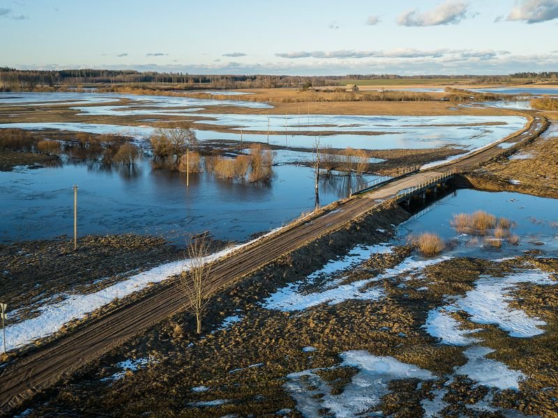
Stormwater drainage for residential plans starts with surveying before it starts with design. A hydraulic designer cannot set flow paths, culvert sizes or street gradients without an accurate model of the ground: where wadis and shi'ab run, what natural ground levels are, and how the site connects to its surroundings. The surveyor's role is to provide that picture, set out the design on site, and verify after construction that slopes and levels match the plan.
Looking for the best surveying office in Saudi Arabia? Read our guide to choosing the best surveying office in Saudi Arabia: licence, classification, KSA-GRF17 and deliverables.
Why flooding problems start with survey
Rain is scarce across most of the Kingdom, but short intense storms can turn dry wadis into fast channels. Many neighbourhood flooding problems trace back to plans designed on thin level data, an old wadi ignored during subdivision, or streets built with reversed slopes. A thorough topographic survey that goes beyond the plot boundary prevents most of them.
Stage 1: topographic survey and its extent
- Agree the survey extent with the designer to include the upstream catchment and outlets.
- Establish stable control tied to KSA-GRF17 and an approved height datum, applying a geoid model because GNSS heights are ellipsoidal.
- Survey natural ground with suitable density, denser at breaklines and wadi edges.
- Pick up existing roads, culverts, channels, walls and nearby building entrance levels.
- Produce a digital terrain model and contours at an agreed interval.
See our KSA-GRF17 guide and land surveying in Saudi Arabia.
Stage 2: wadis and flow paths
- Survey the wadi thalweg and regular cross-sections.
- Record banks and signs of past flow such as sediment and gravel lines.
- Add sections at bends, narrows and confluences.
- Document any fill or human change to the natural channel.
Stage 3: levels and slopes
- Use precise levelling for critical levels rather than RTK alone, especially on flat ground.
- Run a two-peg test before starting and balance sight lengths.
- Tie all levels to protected benchmarks for the whole project.
- Set out street centreline, inlet and culvert invert levels precisely and check gradients between points.
Riyadh, Jeddah and Makkah
Riyadh: largely limestone ground crossed by wadis such as Wadi Hanifah and its tributaries; watch small shi'ab descending from high ground and plans sitting in natural flow paths.
Jeddah: flat coastal ground with sabkha, saline soils and a high water table, with wadis from the east heading to the coast. Weak natural fall makes level accuracy critical. See surveying rocky and sabkha ground.
Makkah: mountains, steep slopes and narrow wadis where water gathers and moves fast; survey needs denser points on slopes and a mix of GNSS and total station where mountains block the sky.
Explore city pages from the Saudi Arabia hub, including Jeddah.
Coordinating with designers and contractors
- Agree reference frame, height datum, file formats and contour interval early.
- Deliver raw data and a processed model with a report on control, method and expected accuracy.
- Report field observations the numbers miss, such as recent flow marks or undocumented fill.
- Set out from the same control during construction and survey as-built channels, culverts and streets.
- Flag slope deviations before final paving.
Common mistakes
- Surveying only the plot boundary, not the catchment.
- Using ellipsoidal GNSS heights without a geoid model.
- Sparse points on flat ground where small differences decide flow.
- Ignoring buried old wadi courses.
- Losing unprotected benchmarks during construction.
Approval requirements for plans and drainage change, so check with the relevant municipality, Balady and the GEOSA portal.
FAQ
Is RTK enough for a drainage survey?
RTK suits general survey, but critical levels on flat ground should be checked by precise levelling, tied to known benchmarks with a correct geoid model.
Why survey beyond the plan boundary?
Water reaches the plan from a larger catchment. Without upstream ground and channels, inflow and safe outlets cannot be assessed.
What does the surveyor do after design?
Sets out levels and slopes, follows construction, then surveys as-built channels, culverts and streets to confirm they match the design.
How EL EMAN can help
We are preparing to serve projects in Riyadh, Jeddah, the Eastern Province and other cities with surveying, contracting and equipment sales and rental, and are taking requests now via WhatsApp or the contact form.


