Earthwork quantities, cut and fill volumes, are among the largest cost items on construction and road projects. Accurate measurement of these quantities protects both the client, who pays for what was actually moved, and the contractor, who needs fair compensation for the work performed. Survey-based quantity measurement provides the objective data that both parties rely on.
The measurement process explained
Quantity measurement begins with a baseline: the original ground survey taken before any excavation starts. This survey captures the natural terrain as a three-dimensional surface model. As excavation progresses, the surveyor returns at agreed intervals to capture the current ground surface. The volume of material removed or added is calculated by comparing the two surfaces.
The comparison produces a cut volume, material removed below the original surface, and a fill volume, material added above it. Net volumes determine whether the project needs to import fill from outside or export surplus material, both of which carry significant cost implications.
For a detailed breakdown of how surveying costs are structured in Egyptian projects, including quantity measurement stages, review the factors that influence pricing.
Survey methods for quantity work
Total station grid survey
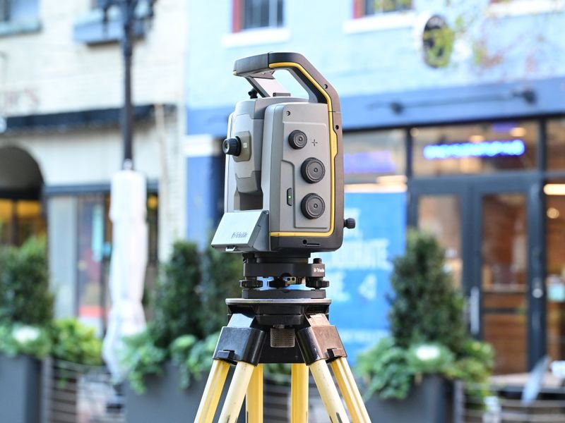
The surveyor shoots points on a regular grid across the excavation area, capturing the current ground level at each point. Grid spacings of 5 to 10 metres are common for open excavations; tighter grids are used where the terrain changes sharply, such as trench edges or benched slopes.
GNSS RTK for large areas
On large earthwork sites, GNSS RTK allows rapid point collection without the need for a line of sight to a base instrument. The surveyor walks or drives the site, collecting hundreds of points per hour. This method is efficient for road corridors, dams, and land reclamation projects where the area exceeds several hectares.
Drone photogrammetry
For very large or difficult-to-access sites, drone-based photogrammetry produces a dense surface model from aerial photographs. The model resolution can exceed what a manual survey achieves, though it requires ground control points surveyed by total station or GNSS for accuracy. This method is growing in use across Egyptian infrastructure projects where speed and coverage are priorities.
Calculation methods
Two standard methods convert survey points into volumes:
- Cross-section method: the site is divided into parallel cross-sections at regular intervals, and the area of cut or fill at each section is calculated. Volumes are then computed between adjacent sections using the average end-area or prismoidal formula. This is the traditional method and the one most commonly specified in Egyptian contract documents.
- Surface-to-surface method: the two surfaces, original and current, are modelled as triangulated irregular networks (TIN), and volumes are calculated from the prismatic columns between them. This method is more precise when the ground is irregular. See our guide on [surveying prices in Egypt](/blog/%D8%A3%D8%B3%D8%B9%D8%A7%D8%B1-%D8%A7%D9%84%D8%B1%D9%81%D8%B9-%D8%A7%D9%84%D9%85%D8%B3%D8%A7%D8%AD%D9%8A-%D9%81%D9%8A-%D9%85%D8%B5%D8%B1-%D8%AF%D9%84%D9%8A%D9%84-%D8%A7%D9%84%D8%AA%D9%83%D9%84%D9%81%D8%A9-%D9%88%D8%A7%D9%84%D8%B9%D9%88%D8%A7%D9%85%D9%84-%D8%A7%D9%84%D9%85%D8%A4%D8%AB%D8%B1%D8%A9) to estimate earthwork survey costs.
Both methods should produce similar results when the survey point density is adequate. Discrepancies usually indicate insufficient points in areas of rapid terrain change.
Reporting and documentation
The quantity report delivered to the client and consultant typically includes:
- A plan showing the survey area boundary and measurement points
- Cross-section drawings at each computation interval
- A volume summary table listing cut, fill, and net volumes
- The original ground surface data for reference
- Any notes on areas excluded from measurement, such as rock or areas not yet accessible
This report accompanies the contractor's interim payment certificate. The surveyor signs the volume calculation, providing an independent verification that the engineer can rely on.
Common sources of error
- Surveying the baseline after preliminary earthwork has already started, which understates the actual volume moved
- Using too few points on irregular ground, which oversimplifies the terrain model
- Ignoring bulking and compaction factors when converting bank volume to hauled or compacted volume
- Failing to survey stockpiled material separately, which can lead to double-counting
El-Eman Office mitigates these issues by establishing the baseline survey before any machinery enters the site and by coordinating measurement stages with the construction programme to capture conditions at the right time.
Reliable earthwork quantity measurement is not about using the most advanced technology; it is about disciplined survey practice, adequate point density, and transparent reporting. These fundamentals ensure that payment reflects reality and that disputes over volumes do not delay the project.