Road construction involves large volumes of earthwork, and the financial value of these volumes makes accurate measurement essential. Under-measurement means the contractor is not paid for work performed. Over-measurement means the owner pays for material that was never moved. Survey-based quantity measurement from cross-sections and levels provides the objective basis both parties need.
How road earthwork quantities are measured
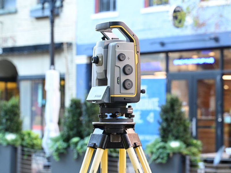
The standard method begins with a topographic survey of the existing ground along the road alignment. The surveyor captures levels at regular intervals along the centerline and at offset points across the width. These measurements generate cross-sections that show the ground profile at each station.
The design cross-sections, produced by the road engineer, show the proposed road surface, subgrade, and side slopes at the same stations. The difference between the existing ground and the design profile determines whether material must be cut or filled at each location.
Volumes are then calculated between adjacent cross-sections using methods such as the average end-area formula or prismoidal correction. The result is a station-by-station breakdown of cut and fill quantities that can be verified independently by both the owner and the contractor.
Field survey procedures
For a professional road survey, the cross-section interval depends on the terrain complexity and the project specification. Common intervals in Egyptian road projects are 20 meters on straight sections and 10 meters on curves or where the ground changes rapidly.
At each station, the surveyor captures enough points to define the ground shape accurately. On flat terrain, five to seven points across the section may suffice. On irregular ground or in areas with ditches and embankments, more points are needed. Missing a significant ground feature at a station can distort the calculated volume by hundreds of cubic meters over a long stretch.
Intermediate surveys
Earthwork is a progressive activity. The contractor does not excavate the entire alignment at once. Intermediate surveys capture the ground surface at various stages of completion, allowing the project team to calculate the quantity completed in each payment period.
These intermediate surveys use the same control points and the same cross-section stations as the original survey. Consistency in measurement methodology is critical for credible quantity calculations.
Common sources of error
The most frequent errors in road earthwork measurement include:
- Inadequate cross-section spacing that misses terrain variations
- Failure to capture the full width of the disturbance area
- Using outdated original ground data that does not reflect recent site changes
- Calculating volumes without accounting for bulking and compaction factors
- Mixing different coordinate systems between the original and progress surveys
Each of these errors can shift the calculated quantity by five to fifteen percent, which on a multi-kilometer road project represents a significant financial impact.
Software and deliverables
Survey data is typically processed in software such as Civil 3D, which generates cross-section plots, volume tables, and mass haul diagrams. The mass haul diagram is particularly useful for planning where excavated material will be deposited, minimizing haul distances and transportation costs.
The deliverables provided to the client should include labeled cross-section drawings at each station, a summary volume table, and a mass haul analysis. These documents support both interim payment certificates and final account negotiations.
Practical recommendations
If you are managing a road project in Egypt, ensure that the survey scope covers both the original ground survey and periodic progress surveys at agreed intervals. Specify the cross-section spacing and the volume calculation method in the contract to avoid disputes later. For guidance on typical survey costs and scope for road projects, our pricing guide provides relevant benchmarks.
El-Eman Office delivers road survey services from the initial topographic survey through final as-built measurements, with all data processed and presented in formats compatible with Civil 3D and other standard engineering software.